From Vallorcine to Chamonix. A Triumph of Spirit, Scenic Splendor, and Unexpected Connections
As our UTMB adventure nears its conclusion, Day 7 beckons us to traverse the final stretch from Vallorcine to Chamonix, via Col Des Monte’s, La Téte Aux Vents ( altitude 2,127m) and La Flégére. With an elevation gain of 967mm average 5.2% and a descent of 1,202m average 6.5%, Total 19.5km, this leg promises both challenges and rewards, marking the culmination of our unforgettable journey.
Beginning the Day: A Cheerful Encounter and Commence from Vallorcine
We took a train near our basecamp to the starting point of the day - Vallorcine.
Our adventure began with an uplifting moment at the Vallorcine train station, where we met a seasoned hiker and UTMB finisher. Having observed our group on the trail previously, she expressed admiration for the joy and unity we exhibited during our hike. In a gesture of solidarity, she took a photograph to commemorate the spirit of our team. This serendipitous meeting filled us with vigor, and we set off along the trail, welcomed by charming wooden sculptures and scenic campsites.
Ascending Towards Majestic Heights: Aux Vents and Alpine Wonders
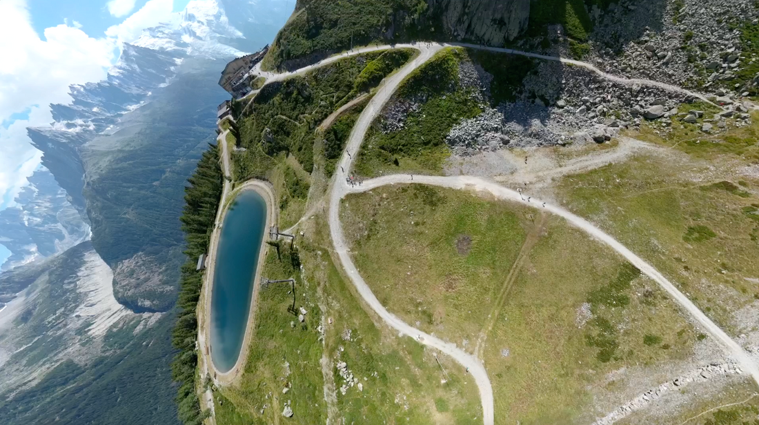
Leaving Vallorcine behind, we set our sights on La Téte Aux Vents, a daunting ascent that tested our determination. With hiking poles in hand, we tackled the steep zigzag path, each step bringing us closer to the summit. As we ascend, the valley villages shrink below us, and the awe-inspiring peaks of the Mont Blanc massif loom majestically across the horizon. Amidst the breathtaking scenery, we paused frequently to capture the moments, our hearts full of gratitude for the beauty that surrounded us.
Upon reaching the summit of La Téte Aux Vents at an altitude of 2,127m, we were greeted by a panoramic view that took our breath away. The summit offers a vantage point to behold the grandeur of Mont Blanc once more, a fitting reward for our perseverance and determination. The view includes summits like Aiguille Verde (4,122m), Les Drpites (4,000m), Les Drums (3,754m), Aguille de Tour (3,544m), Aiguille de Chardonette (3,824m) and glaciers include Glacier de Tour, Glacier de Lognan, Glacier de la Pendant. It was just spectacular!
Amidst the awe-inspiring vistas, some of us took a moment to meditate, connecting with the mountain's energy and harmonizing our inner vibrations with the serenity of the surroundings.
Descending to Tranquil Terrains: La Flégére and Riverside Revelry
With spirits rejuvenated and hearts uplifted, we began our descent from La Téte Aux Vents towards La Flégére, where a well-deserved lunch awaited us at Les Deux Aigles. Set against the backdrop of sweeping mountain views, we indulged in delicious fare and friendly banter, cherishing the camaraderie forged during our journey.
Continuing our descent towards Chamonix, we found solace in the serene forest paths, guided by the soothing melody of nearby rivers. Passing by the charming Chalet La Floria, adorned with vibrant flowers and offering sweeping views of Mont Blanc, we paused for a moment to contemplate the breathtaking beauty of nature that enveloped us.
A Joyful Conclusion: Reflections and Fulfillment
As we approach the Paroisse Saint Bernard du Mont-Blanc, where our adventure began seven days ago, a sense of fulfillment washed over us. Gathering as a group, we raised our flag in triumph, celebrating the completion of the UTMB loop through this scenic hike. Though our journey may have come to an end, the memories made and lessons learned will remain etched in our hearts forever.
Stay Tuned for More Adventures
As we bid farewell to the UTMB route, our hearts were filled with gratitude for the treasured memories forged and the invaluable insights gained throughout our journey. Join us as we continue to embrace the spirit of adventure and inspire others to chase their dreams, one step at a time, every mile is a smile.
Take a look into the stunning pictures >>> UTMB Hike : Day 7

Check this out >>> GPX file of the UTMB Full Route
Satellite view of the UTMB Day 7 Route

Terrain view of the UTMB Day 7 Route

Related blogs:
> Embracing the Majesty of Mont Blanc
> 7 Days Hiking the UTMB 170 Km Race Route - Day 1
> Hiking the UTMB 170 Km Route - Day 2
> Hiking the UTMB 170 Km Route - Day 3
> Hiking the UTMB 170 Km Route - Day 4
> Hiking the UTMB 170 Km Route - Day 5
> Hiking the UTMB 170 Km Route - Day 6
#UTMB #HikingAdventure #AlpineWonders


